
Hill Creek Herd Area
Several hundred mustangs roam this patchwork of federal, state, tribal and private land along the eastern bank of the Green River.
a piece of Wild Horse Heaven ... with gas wells
The tiny reservation community of Ouray rests at the confluence of the Duchesne and Green Rivers, some 30 miles south-southwest of Vernal (about the same distance southeast of Roosevelt). Not two miles south, the White River flows in from Colorado to meet the Green from the opposite direction, marking Ouray as perhaps the lowest habitable location in Uintah County (about 4,660 ft above sea level).
The Uintah and Ouray Ute Reservation extends southward from Ouray through a narrow band extending about a mile to either side of Seep Ridge Road (the only paved road into this area) for the first ten miles south from the river. Roadside sightings are very likely along this stretch, especially through the first few miles after crossing the White River bridge. The remaining length of Seep Ridge Road, roughly 45 miles to the Grand County border, passes through BLM and privately-owned land. Most of the private land is owned by natural gas development corporations, and you will immediately notice that natural gas drilling is a favored activity in these parts, no matter who owns the land.
Tribal lands continue in a southwesterly direction along Hill Creek, broadening to encompass an area extending 20 miles east from the Green River at the county’s southern border. This contiguous stretch of tribal land bifurcates the BLM’s defined herd area into northwest and southeast sections.
The Wild Horse Bench area (northwest section) lies between the Green River and Hill Creek, accessed just south of the White-Green confluence. Agency Draw (southeast area) includes the Willow Creek Canyon, about 27 miles further south. It is impossible to access either of these areas without passing through tribal land, portions of which are expressly off-limits to unauthorized travelers (I learned this the hard way). Follow the routes defined here carefully, remaining on the road while passing through tribal lands, and you’ll be fine.
Throughout this labyrinth of public, private and tribal lands, there are no effective barriers (natural or artificial) preventing these horses from migrating and intermingling freely. In typical mustang fashion, they thumb -- that is, they hoof their noses at hominid notions of boundaries. As such, differentiating tribal horses from American mustangs amounts to noting where any given horse happens to be grazing at any given time.


Getting There
Start with a full tank of gas in Roosevelt (or Vernal). Take US-40 about 14.5 miles east from Roosevelt (about the same distance west from Vernal) to Utah Highway 88. Watch for the sign pointing toward Pelican Lake and the Ouray National Wildlife Refuge between mile markers 130 and 131. Travel southward past Pelican Lake, about 17 miles to Ouray and the Green River crossing.


viewing locations
Northern Seep Ridge Road: As mentioned above, sightings are common along this paved route for the first 8 to 10 miles south of Ouray. Remember that you are on tribal land through this stretch, so no hiking! Just stay in your vehicle and enjoy the view.


Wild Horse Bench Area: travel southward from Ouray, crossing the smaller White River. Continue another 0.9 mile beyond the White River bridge (2.4 miles from the Green) to Lower Willow Creek Road (dirt road with a stop sign on your right). Turn right onto Lower Willow Creek Road. This road is far from smooth, but the family sedan should have no problem in dry conditions. You’ll enter BLM land 2.5 miles west. Keep left when the road forks half a mile later, just beyond the stunning weathered butte (you can’t miss it). Remain on this road, crossing the Willow Creek bridge and continuing south into the natural gas fields.
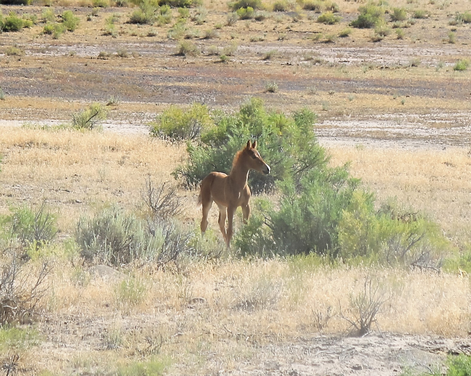
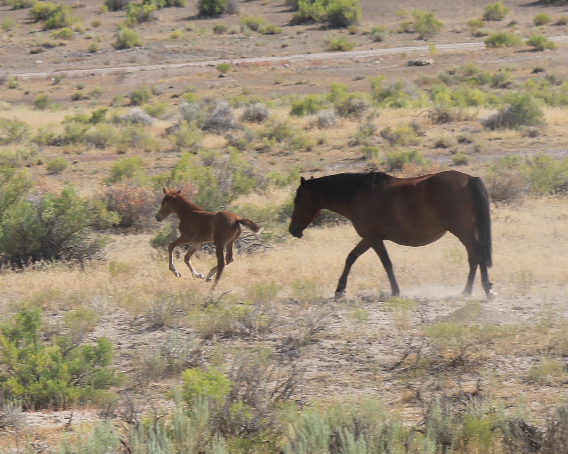
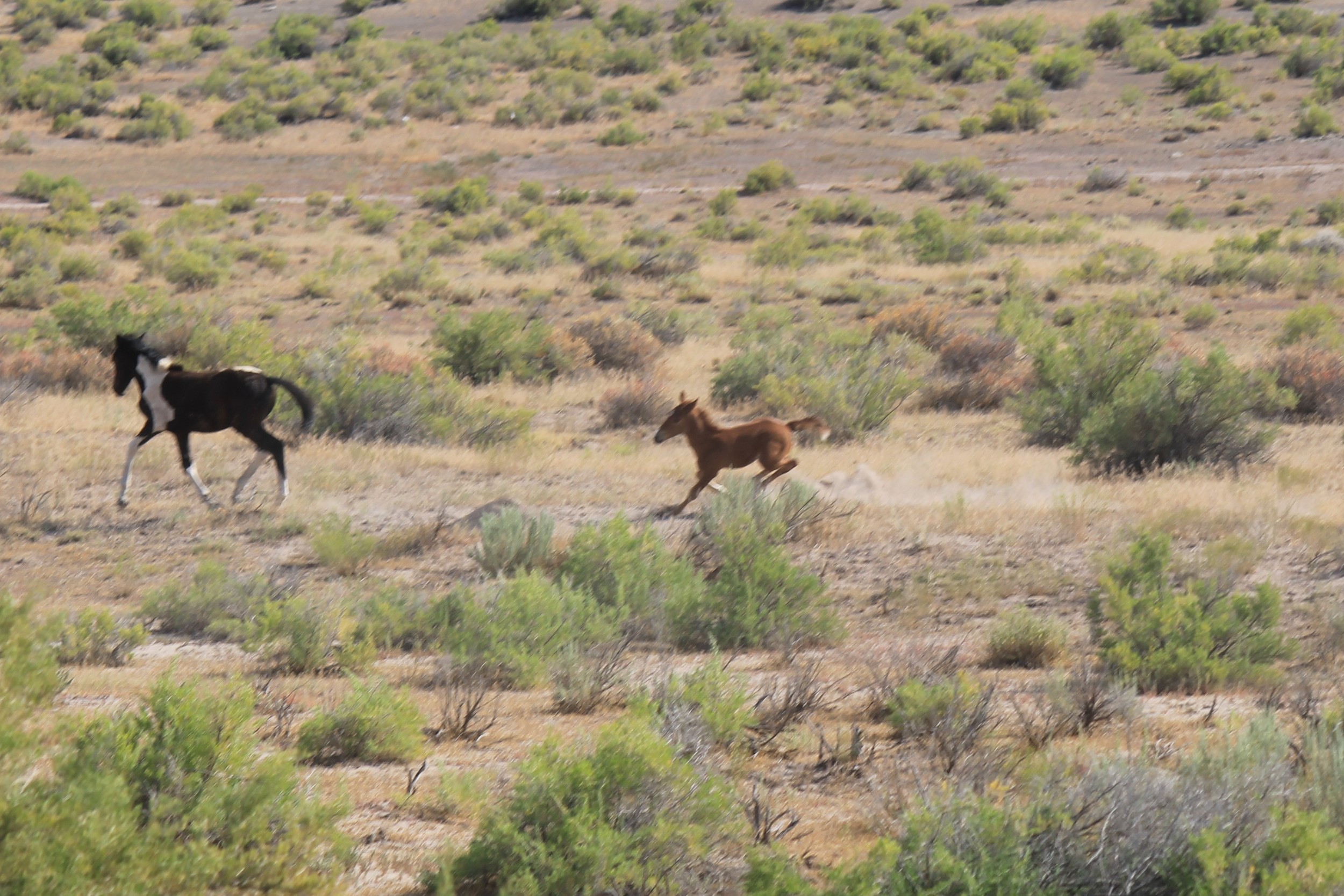
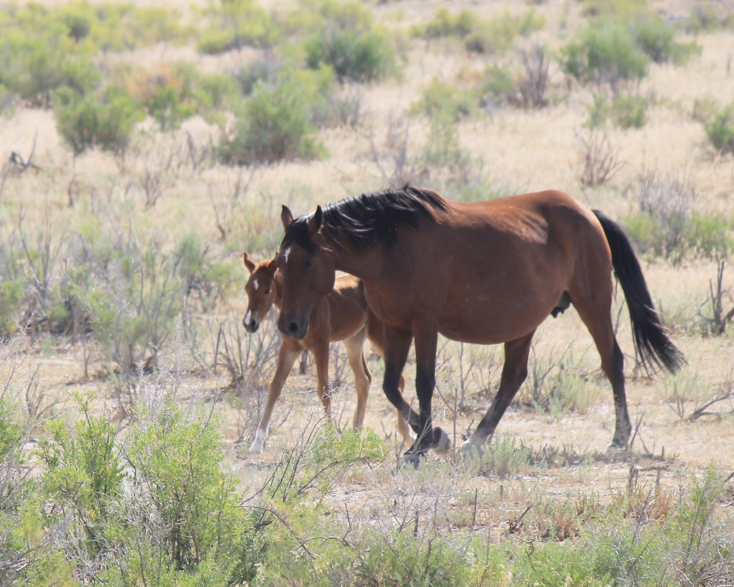
The defined heard area is located about 8 miles further south, but I have not yet mapped the best path through this maze of well roads and pump sites. Fortunately, as discussed earlier, mustangs don’t give a donkey’s derrière about herd area boundaries, so encounters do occur in this more northerly area. The photos above were taken at the end of a jeep trail leading to a heavily wooded area along the riverbank, about 1.5 miles south of the Willow Creek Bridge, then ¾ of a mile west (the trail picks up from the graded road just before you reach the pump station).


Agency Draw Area (alternate access route to Winter Ridge Herd Area): This is a high-clearance 4WD route, primarily due to occasional patches of deep standing water and mud, as the dirt road winds slowly through the flat wetlands of the ridiculously gorgeous Willow Creek Canyon. You may access the canyon in the family sedan, but be warned that you may have to find a place to turn around and climb back out before you see much of anything.
Begin by travelling south to mile marker 25. Watch for the sign indicating the Buck Canyon Road turnoff. You’ll find a small rest stop on the east side of the road, opposite this turnoff. After using the facilities (better safe than sorry), follow Buck Canyon Road west about 3.2 miles to the Bull Canyon/Willow Creek Road turnoff. As the sign at this intersection indicates, you are actually just inside tribal land at this point, but turn left here and keep driving – you’ll be back in the land of the free before you know it. Follow Willow Creek Road southward as it twists and winds through the valley. Take the right-hand route when the road forks 6.8 miles in (avoiding a private drive). When the road forks again 5.2 miles further along, take the left leg (avoiding tribal land). At this point, you can either turn around and retrace your route or continue into Bull Canyon, climbing up to the Winter Ridge Herd Area.
Much of this bottom land is privately owned – with the notable exception of the Willow Creek Wildlife Management Area – so be respectful of gates: close them behind you if you find them closed and leave them open if you find them open.


Other Points of Interest
Pelican Lake, about halfway between US-40 and Ouray, offers fishing, birding and rustic camping (with restrooms). The public camping and boat launching areas are accessed northwest of the lake.
The Ouray National Wildlife Refuge and Fish Hatchery spans the northwestern banks of the Green River just a few miles north of Ouray. The five-mile automobile tour reaches the river’s edge, with educational signs and an observation tower to entertain you along the way.
The Willow Creek Wildlife Management Area is located along Bull Canyon Road in Willow Creek Canyon. The area covers most of the valley floor from Woods Canyon Road (north) to the Bull Canyon entrance (south).
Willow Creek Canyon itself is a genuine hidden gem -- a ribbon of emerald set within towering walls of red and gold.
Key Coordinates
Exit US-40 to UT-88: 40° 19.156' N109° 41.652' W
Green River Bridge at Ouray, UT: 40° 5.127' N109° 40.566' W
Pelican Lake: 40° 11.001' N109° 41.510' W
Ouray National Wildlife Refuge: 40° 8.052' N109° 38.610' W
White River Bridge: 40° 3.860' N109° 40.447' W
Lower Willow Creek Road: 40° 3.184' N109° 40.947' W
Fork on Lower Willow Creek Road: 40° 1.898' N109° 43.866' W
Lower Willow Creek Bridge: 40° 1.650' N109° 43.988' W
Jeep trail off Lower Willow Creek Rd: 40° 0.079' N109° 44.547' W
Buck Canyon Road: 39° 44.302' N109° 30.132' W
Willow Creek Road: 39° 43.133' N109° 33.227' W
First fork (private drive): 39° 38.768' N109° 30.132' W
Second fork (tribal land): 39° 36.115' N109° 34.186' W
Bull Canyon entrance: 39° 36.470' N109° 33.845' W
Nearest Herd Areas
Winter Ridge: immediately south
Bonanza: 40 miles east