
Range Creek Herd Management Area
Dozens of wild horses roaming a forested plateau, thousands of ancient petroglyphs in the canyons four thousand feet below, tantalizing rock formations emerging from towering golden walls, rustic remnants of settlements centuries past … one of the most beautiful and fascinating day trips you will ever experience.
Small family on the plateau beside Cold Springs Road.
The Range Creek Herd Management Area encompasses over 120 square miles of the West Tavaputs Plateau some 30 miles east of (and ¾ mile above) Price, Utah. The origin of this herd of 200+ horses dates back to the establishment of Preston Nutter’s ranch in the late 1880s. As was common practice among southwestern ranchers through the late 19th and early 20th centuries, Nutter kept a sizeable herd of untamed horses, allowing them to roam wild on neighboring public land, capturing and breaking them as needed to work his herds and holdings. Horses were last captured for this purpose in the 1930s, and their progeny officially became public property with the signing of the 1971 Wild Free-Roaming Horses and Burros Act.
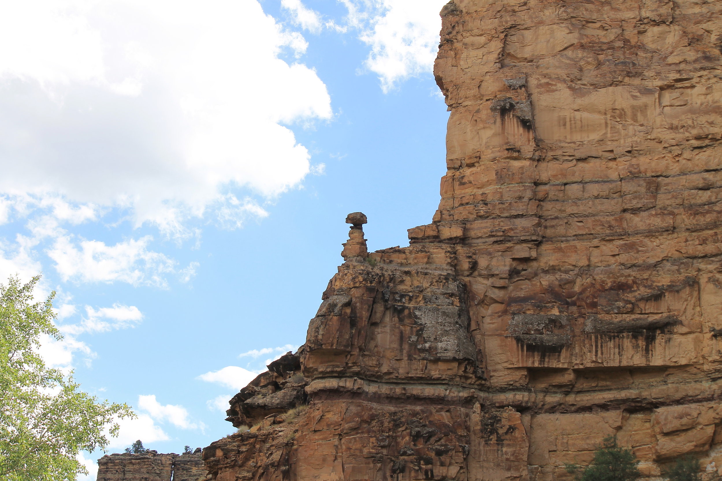
The highest elevations, ranging from nine to ten thousand feet above sea level, are covered in dense aspen and evergreen forest. This vast acreage is privately owned, with large tracts providing no public right-of-way. Most of the land east of this forest is public, including numerous blocks of Utah State Schools and Institutions Trust Land (SITLA), some of which are accessible by permit or to authorized personnel only. This patchwork blend of ownership and accessibility places some areas completely out of reach.


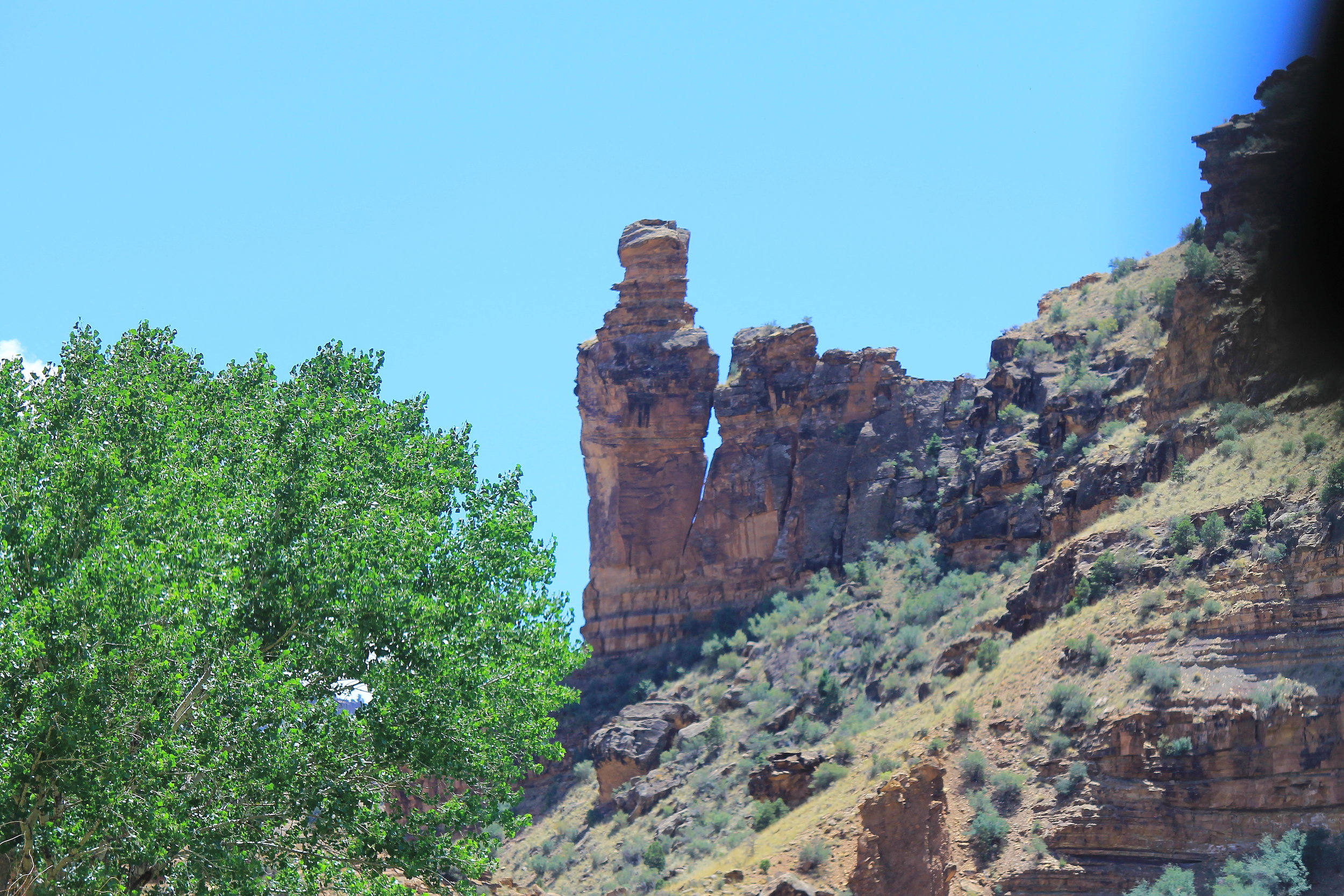
Fortunately, there is a decent route through prime horse country, proceeding directly through one of the most prolific petroglyph displays in the world. This easy 4WD loop through Nine Mile Canyon, up Cottonwood Canyon, across the West Tavaputs Plateau, and back down through Water Canyon offers a continuous variety of beautiful and awe-inspiring sights. This is a day well spent anytime the roads are clear of mud and snow, but late summer/early autumn adds additional color to this unforgettable tour.
The BLM’s webpage for this HMA suggests this loop, which may be travelled in either direction; however, there are advantages and disadvantages to both. The climb onto the plateau is steep enough to strongly recommend four-wheel drive from either direction, but a poorly-maintained SITLA section of the road may make approaching through Cottonwood Canyon a little more challenging. On the other hand, approaching through Water Canyon leaves one travelling west through Nine Mile Canyon, where most of the roadside turnoffs for viewing petroglyphs and ruins are on the eastbound side. All considered, commencing through Nine Mile Canyon is most convenient, and even the neglected SITLA stretch does not require high clearance (unless erosion continues unaddressed).


Getting There
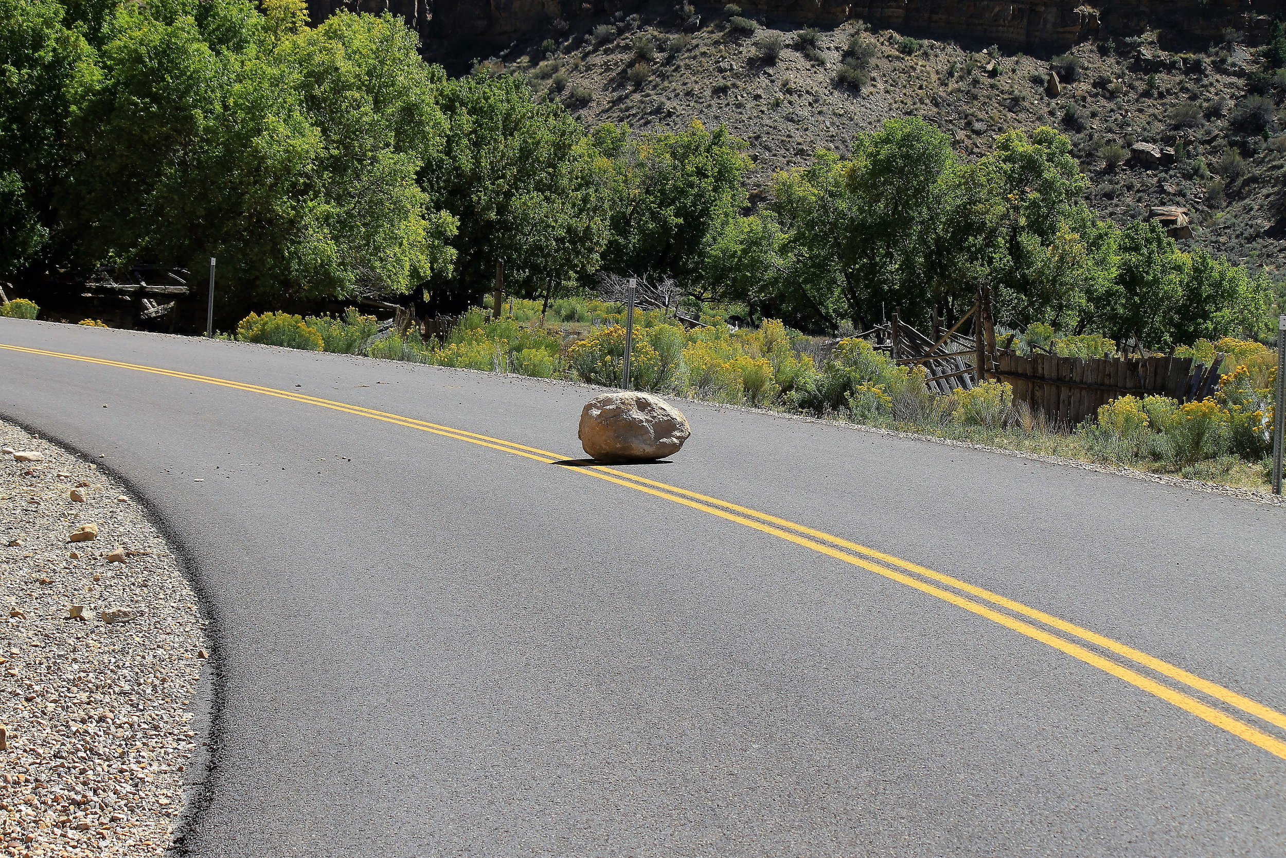
Soldier Creek Road intersects northward from US-6 at the east end of Wellington, UT. Watch for the sign pointing toward Nine Mile Canyon on the right side of the road and the Chevron gas and convenience store on the left (good place to top off your tank). Follow this paved road toward the eastern ridgeline and into the canyon, where the road becomes Nine Mile Canyon Road. Roadside opportunities to view petroglyphs begin about 26.4 miles in from the highway, and become increasingly frequent as you continue 18.6 miles to the fork with Cottonwood Canyon Road.
Nine Mile Canyon Road continues as a dirt road branching off to the left at this point, but remain on the paved route to the right, proceeding another 1.3 miles to The Great Hunt petroglyph panel just inside Cottonwood Canyon. Continue south along Cottonwood Canyon Rd as it becomes an improved dirt road and eventually turns westward and begins to ascend the plateau. You’ll gain over 2,800 feet in altitude over this 11.9-mile stretch, most of this through the last few miles.
Make the 90 degree left turn onto Flat Iron Mesa Road, remaining on the more improved route another 5.6 miles to Range Valley Mountain Road (seriously). The first half of this stretch offers your best chances for spotting mustangs. The last half winds through dense stands of aspen and evergreens (again, privately owned).


Turn right onto Range Valley Mountain Rd (the Preston Nutter Ranch entrance is immediately left), heading west about 1.2 miles toward Bruin Point. Now you will begin a 5.5-mile descent toward Rte 123. The road is winding and narrow, but relatively well-maintained as it drops 2,700 feet toward Highway 123. Turn left onto the highway and continue another 14.3 miles through Sunnyside and East Carbon, ultimately back to US-6 approximately 6.7 miles east of the Wellington Chevron station.
The complete loop covers just over 90 miles in three hours driving time, but allow yourself ample time for numerous stops along the way. If you are day tripping from Salt Lake City, consider an additional four hours and 250 miles to and from Wellington.
Viewing Locations
I have spotted small bands grazing within a couple hundred yards of Flat Iron Mesa Road a few miles east of the forest (as the BLM webpage describes). I have also seen ample hoof prints and road piles on a side-trip along Cottonwood Ridge Road, a more rugged route with high-clearance sections, just below the Preston Nutter Ranch (where public access ends).


Other Points of Interest
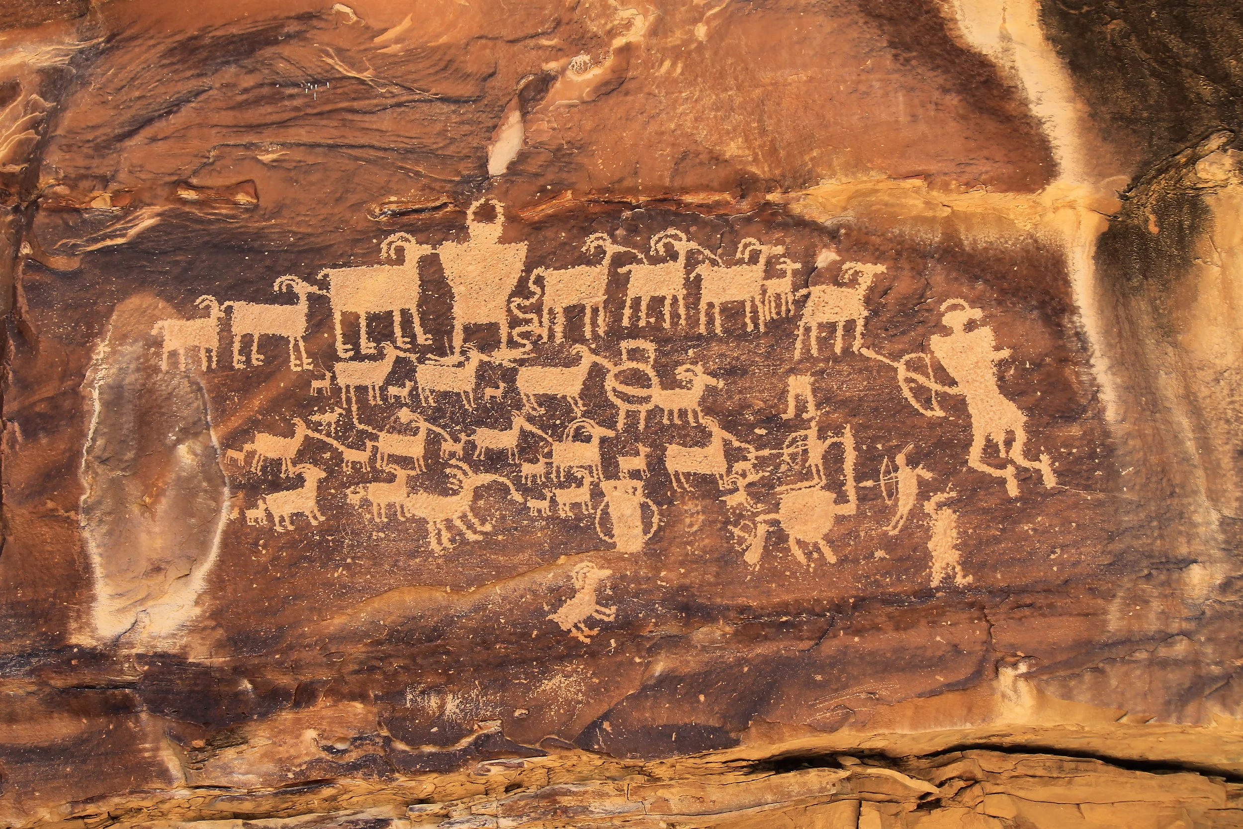
Nine Mile Canyon is actually a 40-mile-long gorge running generally eastward through the West Tavaputs Plateau east of Price and Wellington. Tens of thousands of ancient native American petroglyphs and pictographs adorn the rock walls at perhaps a thousand separate locations. The canyon is enclosed by gorgeous golden-red rock cliffs with fascinating formations just about everywhere you look. Learn more about this desert jewel on this BLM recreation page, which includes a link to a very useful petroglyph guide.
Range Creek Canyon is a limited access archeological site administered by the Natural History Museum of Utah. Public access is by pre-purchased permit only, and limited to 28 visitors per day. Click here for more information about this virtually undisturbed collection of prehistoric sites.
Key GPS Coordinates
Soldier Creek Rd from US-6: 39° 32.560' N110° 41.295' W
Cottonwood Canyon Rd from Nine Mile Canyon Rd: 39° 47.022' N110° 9.069' W
The Great Hunt petroglyph panel: 39° 46.742' N110° 8.117' W
Flat Iron Mesa Rd from Cottonwood Canyon Rd: 39° 41.343' N110° 15.193' W
Range Valley Mountain Rd from Flat Iron Mesa Rd: 39° 38.576' N110° 19.567' W
Bruin Point Rd: 39° 38.434' N110° 20.771' W
Hwy 123 from Bruin Point Rd: 39° 36.006' N110° 22.699' W
US-6 from Hwy 123: 39° 31.551' N110° 34.382' W
Cottonwood Ridge 4WD Rd from Cottonwood Canyon Rd: 39° 43.621' N110° 10.202' W
Preston Nutter Ranch on Cottonwood Ridge Rd: 39° 38.795' N110° 15.068' W
Nearest Herd Areas
Sinbad: 90 miles south
Muddy Creek: 100 miles southwest
Robbers Roost: 120 miles south